National Park Service

Big Cypress National Preserve

Cypress swamp · scenic roads · layered backcountry access

A vast freshwater swamp where paved scenic travel, gravel backroads and permit-controlled off-road access reveal the watershed feeding the greater Everglades.

⌖

GPS25.901° N
81.326° W

$

Estimated 2-Night Spend$200–$750

✓ Source verified · Sep 23, 2026
Image: National Park Service
⌖

Overview

FL

Drive into a 729,000-acre freshwater swamp that protects the watershed feeding the greater Everglades and contains North America’s largest dwarf-cypress forest. Big Cypress is also one of the rare national park units where paved scenic travel, gravel swamp roads, and permit-controlled off-road traditions can all coexist within the same protected landscape.

AgencyNational Park Service
Access modelFull-Spectrum Core
Remote campingStrong Remote Option
Checking destination weather…
⌂

Camping Snapshot

Multiple NPS front-country RV/tent campgrounds along or near US-41, including Midway; backcountry camping and ORV-access campgrounds also exist.

Big Cypress front-country camping | multiple NPS RV/tent campgrounds | Midway has 26 RV sites with electric, drinking water and dump station | check site fit, wet-season conditions and ORV/campground status.

Reservation
All designated NPS campgrounds require reservations through Recreation.gov; current availability and individual site fit are live data.
Water
Midway has drinking water; facility mix varies by campground.
Dump
Midway includes a dump station; campground amenities vary.
Restrooms
Midway has restrooms; facilities vary at more primitive campgrounds.
$

Trip Cost

2 nights / 3 days
Solo$200–$425
Couple$300–$550
Family of 4$450–$750
Planning band, not a quote. Live fees and availability can change.
▣

Vehicle Access

US-41 / Tamiami Trail visitor-center and front-country core

US highway / developed preserve access · Paved

Van SuitableTruck Camper SuitableClass C SuitableOverland SuitableClass A SuitableTravel Trailer Suitable

US-41 provides the universal core through the preserve, linking visitor centers, roadside stops and multiple front-country RV/tent campgrounds.

Current-condition note: Seasonal flooding, storms and temporary facility closures remain live-data items.

Loop Road Scenic Drive

County scenic road · Mostly gravel / unpaved

Van SuitableTruck Camper SuitableClass C ConditionalOverland ConditionalClass A ConditionalTravel Trailer Conditional

Optional scenic zone. Do not imply that large powered/towed rigs are as comfortable here as they are on the US-41 core.

Current-condition note: Wet-season road condition can change; check with NPS before travel.

Designated ORV trail system

Permit-controlled ORV trail · Swamp / designated backcountry trail

Van ConditionalTruck Camper ConditionalClass C UnverifiedOverland UnverifiedClass A UnverifiedTravel Trailer Prohibited

Optional adventure zone only. Permit and inspection requirements govern vehicle eligibility; travel trailers are not an ORV platform for these trails.

Current-condition note: Trail openings, closures and water conditions are highly dynamic.

▤

Nearby Resources

Quick planning essentials
Fuel: Gasoline

Everglades City / SR-29 corridor

7 mi · W / SW of Nathaniel P. Reed Visitor Center

NPS identifies Everglades City as the closest small community for food/lodging; exact fuel provider and hours should resolve live.

Driving Directions ↗
Groceries

Everglades City

7 mi · W / SW of core

NPS notes a small grocery store in Everglades City and very limited food options within the preserve.

Driving Directions ↗
Fuel: Diesel

Naples / I-75 / SR-29 corridor

30 mi · NW / W of core

Larger-rig diesel planning matters because services inside the preserve are sparse; use live truck-friendly station data.

Driving Directions ↗
Repair/Parts

Naples / East Naples service corridor

35 mi · W / NW of core

Preserve remoteness makes current towing, tire and repair availability especially important; resolve providers live.

Driving Directions ↗
Hospital

NCH Baker Campus Emergency Department, Naples

45 mi · NW of core

24/7 emergency care in Naples; distance is intentionally approximate because route choice from the preserve varies.

Driving Directions ↗
⌖

See Nearby

Local culture & context
Visitor center / swamp orientation

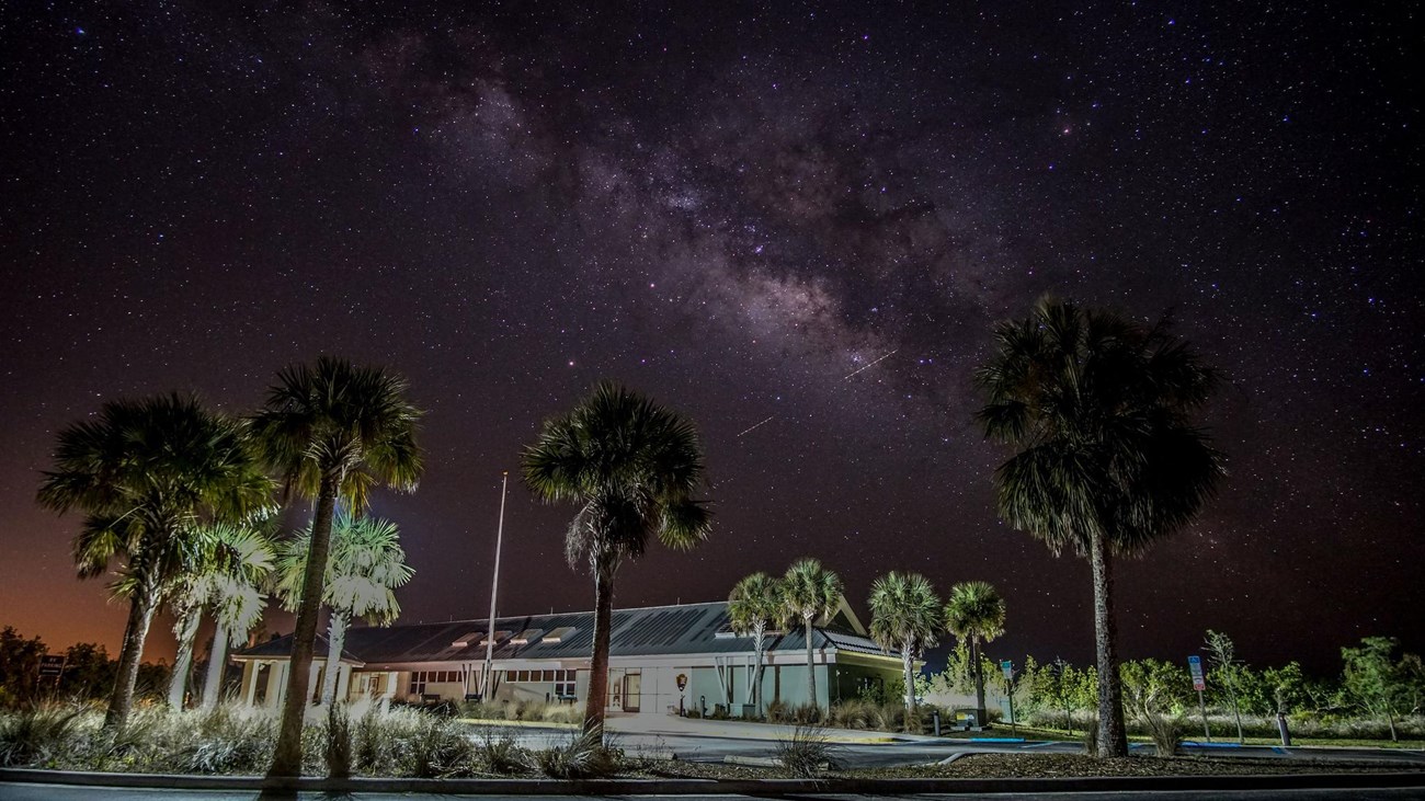
Nathaniel P. Reed Visitor Center

Nathaniel P. Reed Visitor Center illuminated beneath the Big Cypress night sky
Image: National Park Service / Public Domain

0 mi · At anchor · 45–75 min · Check current cost

Primary orientation point with indoor/outdoor exhibits, preserve film, ranger information, bus/RV parking and direct US-41 access.

Cypress strand / boardwalk

Kirby Storter Boardwalk

Boardwalk and cypress landscape at Kirby Storter Roadside Park in Big Cypress
Image: David Berkowitz / CC BY-SA 2.0

12 mi · E along US-41 · 45–75 min · Check current cost

One-mile round-trip boardwalk from sawgrass prairie into mature cypress swamp and a gator-hole overlook; currently subject to post-fire partial closure.

Wildlife / boardwalk

Oasis Visitor Center Boardwalk

Alligators beside the boardwalk at Oasis Visitor Center in Big Cypress National Preserve
Image: Pietro / CC BY-SA 3.0

20 mi · E on US-41 · 30–60 min · Check current cost

Accessible canal-side boardwalk with frequent wildlife viewing, including alligators, plus visitor information and RV/bus parking.

Cypress swamp / wildlife boardwalk

H.P. Williams Roadside Park

Cypress landscape in Big Cypress National Preserve
Image: National Park Service / Public Domain

Along US-41 / Tamiami Trail · 30–60 min · No separate fee

A short accessible boardwalk along the Tamiami Trail overlooking cypress swamp and a wildlife-rich waterway.

Cypress swamp along Loop Road in Big Cypress National Preserve
Image: Gzzz / Wikimedia Commons

WORTH THE DETOUR

Loop Road Scenic Drive

Roughly 24 miles through cypress swamp south of US-41; road conditions can change quickly with rain, potholes and wet-season conditions.

18 mi · SE / S of US-41 core · 2–4 hr

Driving Directions ↗

Best vehicle-based extension for travelers who want to leave the highway and experience the swamp at road level. · nps.gov · Current details checked 2026-09-23.

Accuracy note: This digital guide shows the best verified information currently available. Categories without reliable source data may be omitted. Conditions, access, services, and supporting details are continuously reviewed and updated as better information becomes available.

✎

Share Field Info

Help keep the guide current

Recent firsthand information enters a moderation queue and never overwrites verified publication data automatically.