National Park Service

Big South Fork National River & Recreation Area

Sandstone gorges · natural arches · whitewater

A large river-and-gorge landscape where sandstone arches, whitewater, plateau roads and Appalachian cultural history overlap.

⌖

GPS36.488° N
84.697° W

$

Estimated 2-Night Spend$190–$700

✓ Source verified · Sep 23, 2026
Image: National Park Service
⌖

Overview

KY

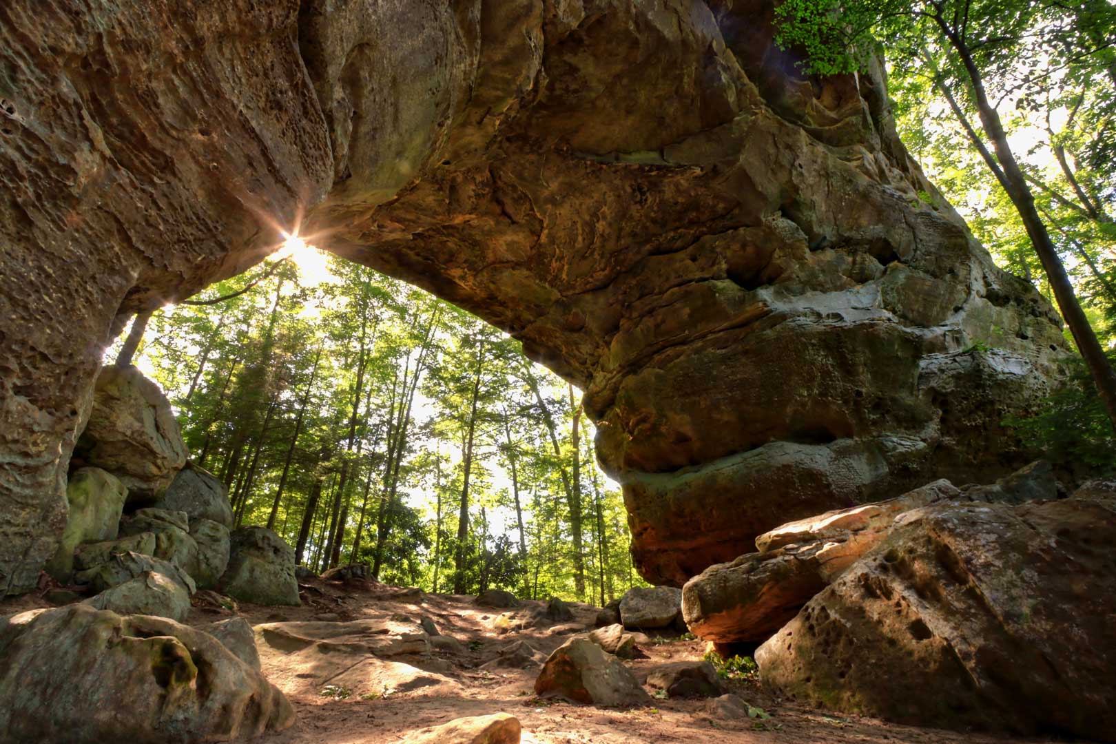
Follow a free-flowing Cumberland Plateau river through deep sandstone gorges in a landscape that NPS says may contain more natural arches than any other region in the eastern United States. Add whitewater, plateau roads, and a human story stretching from ancient occupation to coal and timber communities.

AgencyNational Park Service
Access modelFull-Spectrum Core
Remote campingStrong Remote Option
Checking destination weather…
⌂

Camping Snapshot

Bandy Creek developed campground with trailer, tent and group sites; other developed/backcountry options exist elsewhere in Big South Fork.

Bandy Creek | 181-site developed NPS campground | 96 trailer sites with water/electric | restrooms, showers and dump station | black-bear food-storage rules apply | check site length and availability.

Reservation
Bandy Creek is on the reservation system; individual sites can be reserved up to 180 days ahead. Exact site lengths are published separately.
Water
Water hookups on 96 trailer sites; developed campground water/restroom facilities.
Dump
Dump station near the registration kiosk.
Restrooms
Restrooms and showers available in the campground.
$

Trip Cost

2 nights / 3 days
Solo$190–$375
Couple$275–$500
Family of 4$425–$700
Planning band, not a quote. Live fees and availability can change.
▣

Vehicle Access

Bandy Creek Visitor Center / Campground core

State highway / developed campground · Paved highway and developed campground roads

Van SuitableTruck Camper SuitableClass C ConditionalOverland ConditionalClass A ConditionalTravel Trailer Conditional

Use Bandy Creek as the universal developed core. The campground has 96 trailer sites with water/electric hookups and publishes site-specific lengths; large/towed classes must select a fitting site.

Current-condition note: Bandy Creek is open year-round; road construction/closures elsewhere in the park should be checked live.

▤

Nearby Resources

Quick planning essentials
Repair/Parts

Oneida, TN service corridor

15 mi · E of Bandy Creek

Repair, parts and towing should be surfaced live because distances increase quickly away from Oneida.

Driving Directions ↗
Hospital

Big South Fork Medical Center

15 mi · E of Bandy Creek

24/7 hospital/emergency care at 18797 Alberta St, Oneida.

Driving Directions ↗
Fuel: Gasoline + Diesel · Groceries

Oneida, TN

15 mi · E of Bandy Creek

Remote plateau travel makes diesel planning important for larger rigs. NPS places Bandy Creek about 15 miles west of Oneida; use live data for current stations. Oneida is the primary nearby full-resupply town for the Bandy Creek core.

Driving Directions ↗
⌖

See Nearby

Local culture & context
Natural arch / hiking

Twin Arches

Twin Arches sandstone formation at Big South Fork
Image: National Park Service / Public Domain

Optional hike from developed trailhead · 2–4 hr · Check current cost

A pair of enormous sandstone arches, including South Arch with a span greater than 135 feet and deck height around 103 feet.

Visitor center / cultural landscape

Bandy Creek Visitor Center / Historic District

Bandy Creek Campground in Big South Fork National River and Recreation Area
Image: Sharon Mollerus / CC BY 2.0

At anchor · 45–90 min · Check current cost

Orientation stop for maps, history and current conditions in the Tennessee core of the recreation area.

River access / hiking

Leatherwood Ford

Big South Fork of the Cumberland River at Leatherwood Ford
Image: Brian Stansberry / CC BY 3.0

Near Bandy Creek core · 1–3 hr · Check current cost

Accessible river corridor and trail hub that shows the free-flowing Big South Fork at close range.

Coal-mining history / heritage

Blue Heron Mining Community

Historic coal tipple at the Blue Heron mining community in Big South Fork
Image: Brian Stansberry / CC BY 3.0

Kentucky side / near Blue Heron campground · 1–2 hr · Check current cost

Interpretive mining-community site preserving the story of a company-owned coal town in the Big South Fork region.

WORTH THE DETOUR

Gather Coffee Lounge

Oneida’s flagship community coffee lounge combines locally roasted coffee, scratch-baked goods, rotating local art and a stage for music and spoken-word events. Its strong review signal makes it a useful small-town cultural counterpoint to Big South Fork’s backcountry focus.

Local · 1–1.5 hr · $

Driving Directions ↗

213 Depot St, Oneida, TN 37841 · gather.coffee · Current details checked 2026-09-25.

Accuracy note: This digital guide shows the best verified information currently available. Categories without reliable source data may be omitted. Conditions, access, services, and supporting details are continuously reviewed and updated as better information becomes available.

✎

Share Field Info

Help keep the guide current

Recent firsthand information enters a moderation queue and never overwrites verified publication data automatically.