National Park Service

Cape Hatteras National Seashore

Buxton / Cape Point

The Buxton/Cape Point area combines ordinary paved access via NC-12 (North Carolina Highway 12) with a separate beach-driving environment where ORV permits and changing ramp conditions matter.

⌖

GPS35.251° N
75.528° W

▣

Best SeasonSpring · Summer · Fall

$

Estimated 2-Night Spend$175–$600

✓ Source verified · Sep 22, 2026
Image: National Park Service
⌖

Overview

Buxton · NC

Experience a living barrier island at one of the Atlantic coast's great geographic pressure points. Offshore, the Gulf Stream meets the south-flowing Virginia Drift near shifting Diamond Shoals, helping create the dangerous waters behind the "Graveyard of the Atlantic." On land, the nation's first national seashore combines maritime history, dark skies, surf fishing, maritime forest, beach camping, and the unusual option to drive designated stretches of ocean beach.

AgencyNational Park Service
Access modelFull-Spectrum Core
Remote campingDeveloped / Formal Only
Checking destination weather…
⌂

Camping Snapshot

Cape Point Campground (Buxton) and Frisco Campground; both NPS developed campgrounds. Cape Point has 202 sites; Frisco has 127 listed in current NPS overview.

Cape Point + Frisco | NPS developed camping | tent, trailer and RV sites | no utility hookups | potable water, restrooms and cold showers in season | Cape Point has a seasonal dump station; Frisco does not | check current dates, site fit and availability.

Reservation
Cape Point uses same-day reservations only; all reservations/payments are through Recreation.gov. Frisco reservations are also handled through Recreation.gov.
Water
Potable water is available seasonally at Cape Point and Frisco.
Dump
Cape Point: seasonal dump station and water fill available on Lighthouse Road. Frisco: no dump station.
Restrooms
Flush toilets available seasonally at Cape Point and Frisco.
$

Trip Cost

2 nights / 3 days
Solo$175–$300
Couple$250–$400
Family of 4$400–$600
Planning band, not a quote. Live fees and availability can change.
▣

Vehicle Access

Core paved gateway passes for all covered classes; travel trailers remain conditional for parking/turnaround fit. Beach ORV restrictions are an optional access zone and therefore do not disqualify the destination. Travel/camping trailers are prohibited on ORV beach routes, but the primary destination remains accessible.
NC-12 / Cape Hatteras Light Station gateway

State highway / park road · Paved

Van SuitableTruck Camper SuitableClass C SuitableOverland SuitableClass A SuitableTravel Trailer Conditional

Paved NC-12/Lighthouse Road access. NPS explicitly lists auto and bus/RV parking at Cape Hatteras Light Station. Travel trailers are not identified as prohibited at the paved gateway, but parking/turnaround fit should be checked before arrival.

Designated beach ORV routes

Permitted ORV route · Deep sand / beach

Van ConditionalTruck Camper ConditionalClass C ConditionalOverland ConditionalClass A ConditionalTravel Trailer Prohibited

NPS ORV rules are vehicle-requirement based rather than body-style based: road-legal/insured, no more than two axles, required recovery equipment, and capable of deep soft sand. Four-wheel drive is recommended, not mandatory. Any powered class meeting those requirements is conditional rather than automatically prohibited. Travel/camping trailers are prohibited on ORV routes; one- or two-axle boat/utility trailers are allowed.

Current-condition note: Ramp hours, wildlife closures, and access can change seasonally and daily.

Cape Point Campground

Developed campground · Paved campground loop roads and parking pads

Van SuitableTruck Camper SuitableClass C ConditionalOverland ConditionalClass A ConditionalTravel Trailer Conditional

NPS says RVs and trailers are allowed and currently lists a 40-foot maximum total vehicle length for Cape Point sites. Current Recreation.gov individual site records can show larger site-specific driveway/max-vehicle lengths (for example 45–49 feet), so travelers should confirm the current site-specific listing. Treat larger rigs and tow combinations as conditional.

Current-condition note: Open seasonally; current dates and site availability should be confirmed before arrival.

▤

Nearby Resources

Quick planning essentials
EV Charging

ChargePoint - Cape Hatteras Light Station

0.1 mi · At anchor

Public ChargePoint location at the lighthouse complex. Charger availability, connector status and pricing can change; confirm current status before arrival.

Driving Directions ↗
Potable Water · Dump Station

Cape Point Campground

0.8 mi · E / Cape Point complex

Potable water is available seasonally at Cape Point Campground; verify campground operating status before relying on it. NPS lists a seasonal dump station and water fill back up Lighthouse Road for Cape Point Campground. Exact seasonal availability stays live.

Driving Directions ↗
Groceries

Conner's Supermarket

1.2 mi · NW

Full-service locally owned supermarket close to the gateway; useful for trip stock-up and prepared-food resupply.

Driving Directions ↗
Fuel: Gasoline + Diesel · Propane

Cape Point Exxon

1.2 mi · NW

Primary close-in fuel stop for the Buxton/Cape Point gateway. Current directory data lists 24-hour fuel; verify branding and pump status live. Diesel is currently listed at the same close-in fuel stop; live availability should be checked before relying on it. Current local-business data lists propane exchange. Treat this as cylinder exchange, not bulk/refill service, and verify stock live.

Driving Directions ↗
Repair / Parts

NAPA Auto Parts - Buxton Auto & Marine Inc

1.3 mi · NW

Parts, batteries, fluids and trip-saving vehicle supplies; current NAPA listing also shows service/maintenance capability.

Driving Directions ↗
Hospital

Outer Banks Health Hospital

52 mi · N / off 20-mile map

Nearest hospital-level emergency department is well outside the 20-mile planning ring. Official listing shows a 24-hour emergency department; call 911 for emergencies.

Driving Directions ↗
⌖

See Nearby

Local culture & context
Lighthouse / maritime history

Cape Hatteras Light Station

Cape Hatteras Lighthouse with its distinctive black-and-white spiral pattern at Cape Hatteras Light Station.
Image: National Park Service

0 mi · At anchor · 45–90 min · Grounds/visitor experience varies; check current NPS information

The island's signature landmark and a natural orientation point for the Buxton area, with visitor services and maritime-history interpretation.

Museum / local culture

Frisco Native American Museum & Natural History Center

Exterior of the Frisco Native American Museum and Natural History Center in Frisco, North Carolina.
Image: Frisco Native American Museum

8 mi · S · 1–2 hr · Check current admission

Small Hatteras Island museum with Native cultural collections and local Outer Banks material; frequently recommended in community discussions for travelers looking beyond beaches.

Shipwreck / maritime history

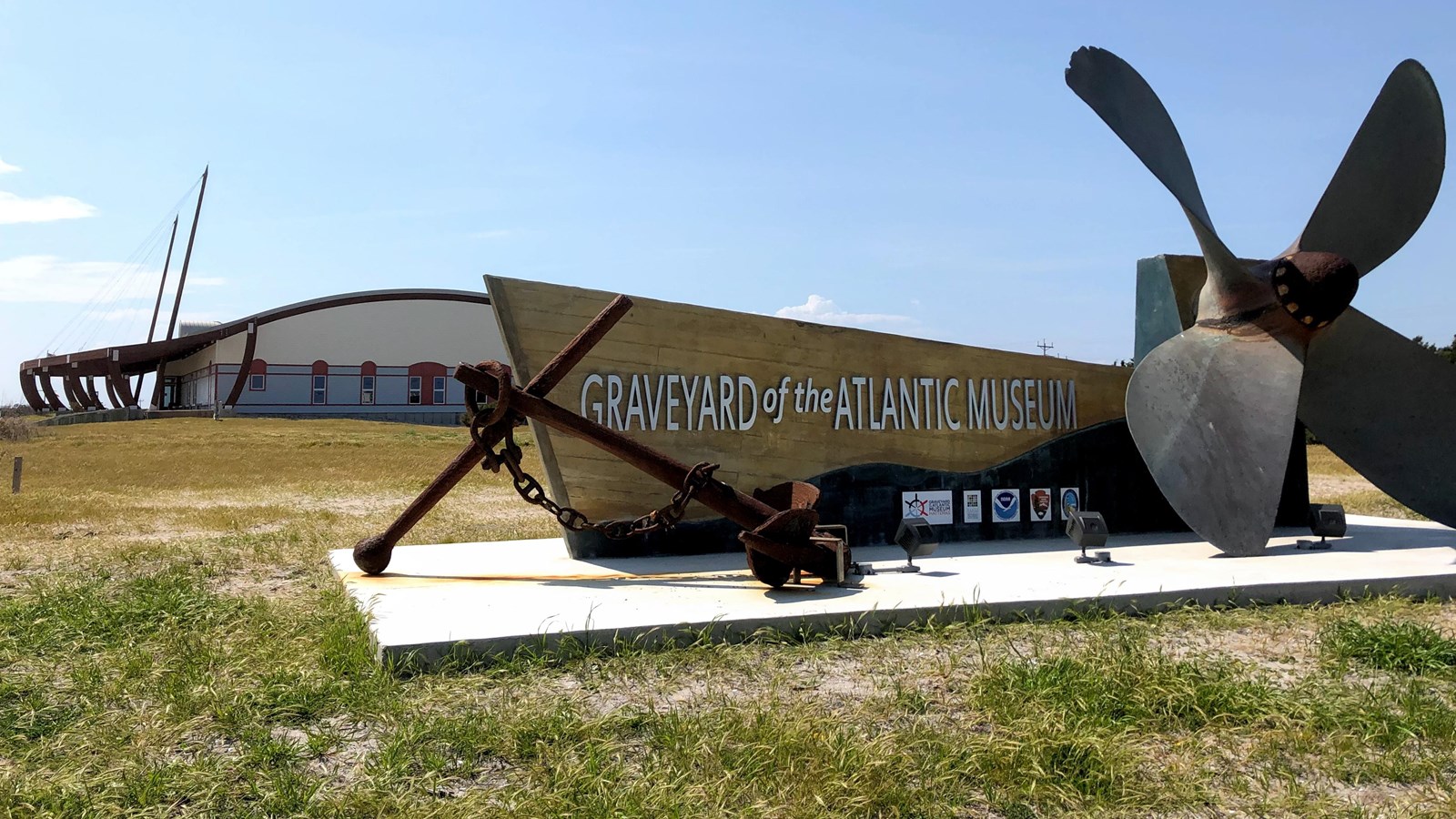
Graveyard of the Atlantic Museum

Graveyard of the Atlantic Museum with its site sign and museum building visible in Hatteras, North Carolina.
Image: National Park Service

10 mi · SW · 1–2 hr · Free

A focused maritime-history stop that explains why these waters became the Graveyard of the Atlantic, including shipwreck, lifesaving and coastal-history exhibits.

Maritime forest / hiking

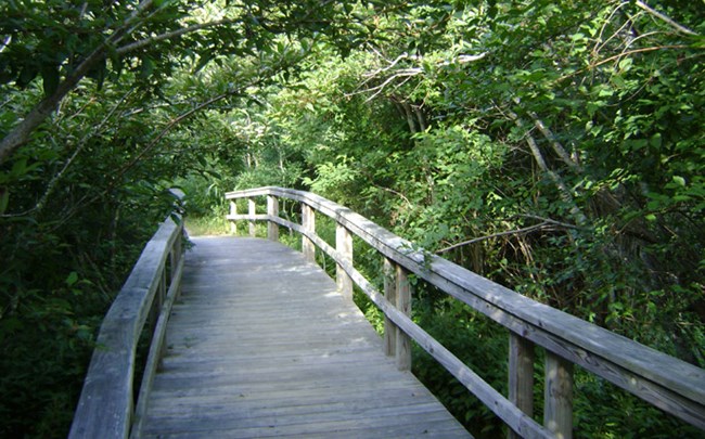
Buxton Woods Trail

Boardwalk and trail through the maritime forest along Buxton Woods Trail.
Image: National Park Service

Adjacent / same gateway area · ~45 min · Free

A short loop through Hatteras Island's maritime forest that offers a completely different landscape from the beach and lighthouse.

WORTH THE DETOUR

Orange Blossom Bakery & Cafe

Long-running Buxton breakfast stop known for its oversized Apple Ugly pastry. It shows up repeatedly in Hatteras visitor recommendations, often with the warning to arrive early.

NW - into Buxton village · 20–40 min · $

Driving Directions ↗

repeated recent traveler consensus continues to single out the Apple Ugly as a Buxton/Hatteras ritual. Keep current hours and sell-out risk through the current source rather than in print. · 47206 NC Highway 12, Buxton, NC 27920 · 252-995-4109 · Current details checked 2026-09-22.

!

Agency Alerts

NPS alerts & conditions

Checking current agency alerts…

Accuracy note: This digital guide shows the best verified information currently available. Categories without reliable source data may be omitted. Conditions, access, services, and supporting details are continuously reviewed and updated as better information becomes available.

✎

Share Field Info

Help keep the guide current

Recent firsthand information enters a moderation queue and never overwrites verified publication data automatically.