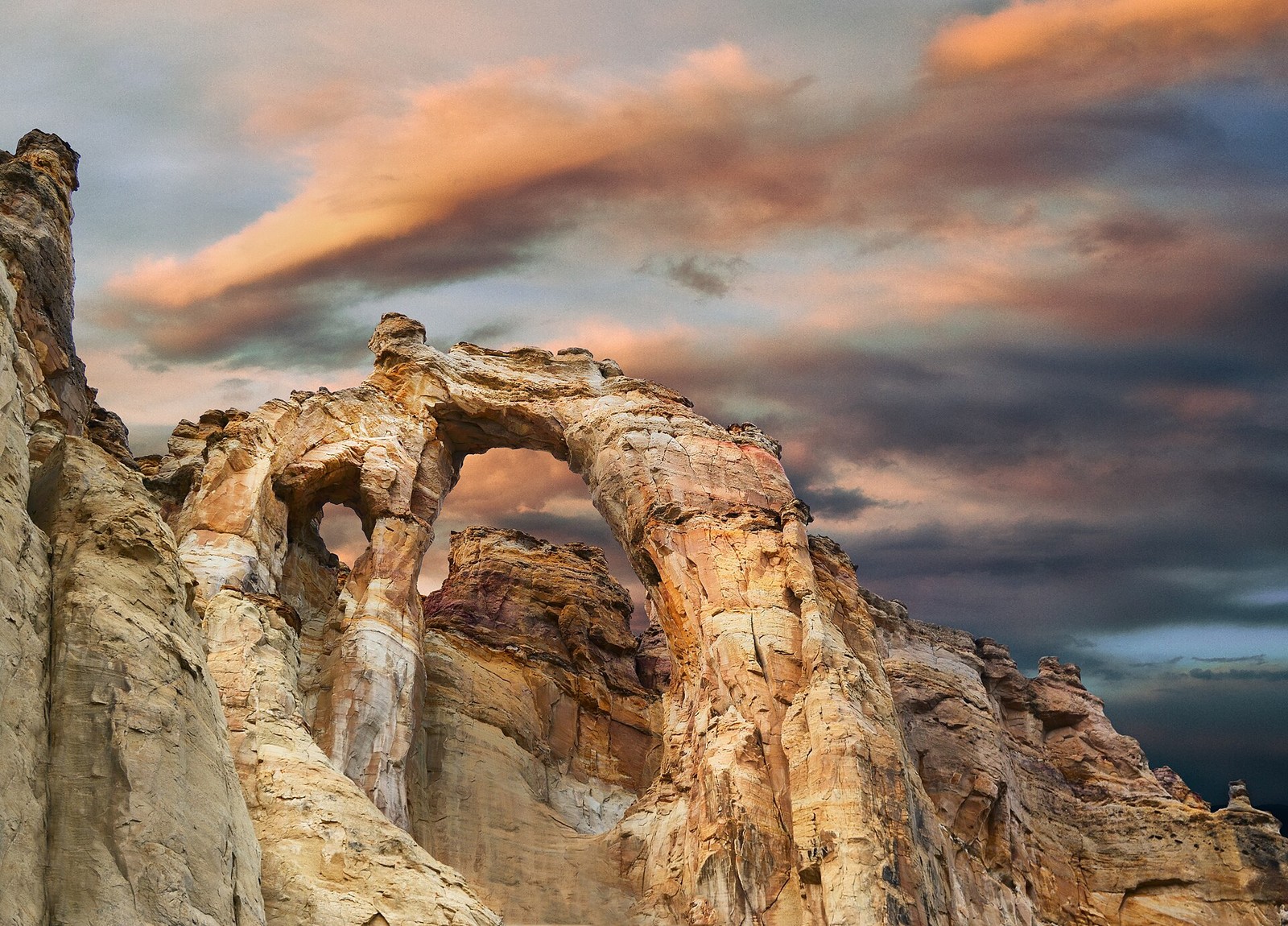
Sedimentary pipes, established camping, and approachable trails make Kodachrome Basin a close-up geology experience that complements the grander amphitheaters around Bryce.
Desert Southwest · Planning notes
Confirm current access, campsite availability and vehicle suitability with the responsible agency or operator.
AgencyUtah State Parks
Access modelSource-Verified Approach / Vehicle Fit Pending
Remote campingDeveloped / Formal Core
Checking destination weather…
Desert Southwest: regional planning
Low desert, plateau and mountain country need separate plans. Exposure, elevation and long distances produce sharply different heat, cold and travel conditions. Use the destination and current agency forecast rather than one regional season assumption.
Seasonal concerns
Desert heat and limited shade; monsoon storms and flash flooding; dust and wind; high-country snow, ice and freezing nights; wildfire restrictions and smoke. Recheck current conditions before each trip.
Regional hazards
Exposure, remote travel, loose sand, washboard, ruts, rocky surfaces, flood-prone washes, steep grades, narrow bends and limited turnaround space. Never treat equipment or a published destination as proof that a route is suitable.
Vehicle considerations
Separate paved gateways from remote dirt approaches. Confirm road legality, private or tribal permissions, surface, grade, clearance, parking and turnaround for the actual vehicle and trailer. Keep a suitable return route and outside-base alternative; do not cross floodwater.
Equipment
Carry terrain-appropriate tires, gauge and inflator; shade and cold layers; lighting and backup power; offline navigation and a second navigation method; first-aid supplies. Recovery gear requires rated attachment points and training; equipment does not make an unsuitable route safe.
Communications
Download maps and instructions before losing service. Offline maps are not emergency messaging. Set a trusted-contact itinerary and check-in plan; select communications appropriate to the remoteness of the route.
Water and fuel
Plan potable water for every traveler and pet, with verified refill and fallback sources. Fuel or charging plans must include return travel and detours; confirm hours, payment and charging compatibility. Use authorized waste disposal and check long-stay permits and resupply needs.
⌂
Camping Snapshot
Kodachrome Basin: Standard sites $35/night; full hookups $45. Arch sites list water/power at $45.
Choose a standard or serviced campsite suited to your equipment and preferred comfort.
Reservation
Kodachrome Basin: $35 standard or $45 hookup site per night; choose the actual campground category.
Water
No campground potable-water detail was verified in the source record; check Nearby Resources and confirm current availability before arrival.
Dump
No campground dump-station detail was verified in the source record; check Nearby Resources and confirm before arrival.
Restrooms
Restroom/shower details were not verified in the campground source record; confirm current facilities before arrival.
$
Trip Cost
Spring scenario; no specific travel dates or future tariff guaranteed
Solo$140–$390
•
Couple$200–$495
•
Family of 4$320–$705
Planning band, not a quote. Live fees and availability can change.
Budget assumptions and sources
Two nights / three days, one vehicle, self-catering, destination walking and viewpoints. No commercial tour except Kartchner cave tour. Family four uses four full food allowances and no child discounts.
Two nights at Kodachrome Basin: $70–$90 per party. Published campsite tariff; site category and party fit must match. Source
Food per person for three days: $60–$105 per person. Planning self-catering allowance, including grocery tax; not a local price survey.
Booking and tax allowance: $0–$20 per party. Arizona $3.60 reservation charge where applicable; remaining upper amount is a planning contingency, not verified tax. Source
Utilities and optional laundry allowance: $0–$40 per party. Planning allowance, not an assertion of local availability. Do not duplicate included site utilities.
Unresolved entry or parking allowance: $0–$60 per party. Planning contingency only. Camping admission inclusion or selected outside parking has not been resolved; not a quoted fee.
Local driving fuel planning allowance: $10–$75 per party. Planning sensitivity allowance, not measured route mileage or current pump prices: roughly 50-150 local miles, 10-20 mpg and $3-$5/gallon, rounded. Replace using the selected routes, vehicle economy and dated fuel price.
Excluded: Travel to and from the region; Optional restaurants, paid excursions, rentals and shopping; Vehicle costs, medical care and recovery.
Entry/parking inclusion is unresolved: the allowance shown is a clearly marked estimate; use the actual charge once known.
Exact travel date, site fit and complete transaction total
Service availability and optional paid nearby visits remain separately flagged
◇
Explore the Area
Destination map with optional cell coverage.
UT
Kodachrome Basin
★
Kodachrome Basin State ParkDestination gateway
USGS topographic map
Loading map…
Map: U.S. Geological Survey, National Geospatial Program.
★ Destination◇ Experiences⌂ Camping+ Essentials
Select a marker for details. Numbered groups zoom into nearby locations.
Google Maps opens separately, so this destination page remains available when you return.
▣
Vehicle Access
Use the paved Cannonville approach. Check dirt-road alternatives separately, especially after rain.
Primary destination access
Planning access · Developed campground access
Van SuitableTruck Camper SuitableClass C ConditionalOverland SuitableClass A ConditionalTravel Trailer Conditional
Check trail exposure, current conditions and campsite category. Do not imply a hookup at every site.
Current-condition note: Confirm current conditions and route status before departure.
✓ Access checked Oct 5, 2026
▤
Nearby Resources
Quick planning essentials
Fuel: Gasoline + Diesel · Potable Water · Dump Station · Repair / Parts
Ruby's Auto Care Center
Operator lists gasoline/diesel, RV fresh water and dump ($20). Confirm potable labeling and whether charge covers desired service. Current operation and eligibility are not confirmed. Distance from this destination has not been measured. Tires, batteries and vehicle service listed; repair facility closed weekends. Confirm specific RV capability.
Facility reference; confirm the service entrance, vehicle access and availability with the operator. Checked 2026-10-05. Resource source
Campground operator lists laundry. Confirm non-guest access and machine fees. Current operation and eligibility are not confirmed. Distance from this destination has not been measured.
Facility reference; confirm the service entrance, vehicle access and availability with the operator. Checked 2026-10-05. Resource source
State park confirms four washers, four dryers and detergent vending. Prices and operating hours require confirmation. Current operation and eligibility are not confirmed. Distance from this destination has not been measured.
Facility reference; confirm the service entrance, vehicle access and availability with the operator. Checked 2026-10-05. Resource source
Operator lists groceries and camping supplies; town address is main property. Current operation and eligibility are not confirmed. Distance from this destination has not been measured.
Facility reference; confirm the service entrance, vehicle access and availability with the operator. Checked 2026-10-05. Resource source
Operator confirms emergency care and 24/7 emergency services; regional access requires a destination-specific route. Current operation and eligibility are not confirmed. Distance from this destination has not been measured.
Facility reference; confirm the service entrance, vehicle access and availability with the operator. Checked 2026-10-05. Resource source
Stand beneath a paired arch formation reached from the Cottonwood country south of Kodachrome. The short on-site visit delivers a distinct sandstone scene without requiring a long hike.
See driving directions · 30–60 min on site suggested visit · Check current BLM access information
Accuracy note: This guide combines dated source records with planning notes. Missing information is not confirmation that a facility or route is available. Conditions, access and services can change; confirm current details with the responsible agency or operator before travel.
✎
Share Field Info
Help keep the guide current
Recent firsthand information enters a moderation queue and never overwrites verified publication data automatically.