Go underground into the world’s longest known cave system, with more than 426 surveyed miles and new passages still being mapped. Above it, the Green and Nolin river valleys and south-central Kentucky karst hills turn Mammoth Cave into a multi-day landscape rather than a single cave tour.
AgencyNational Park Service
Access modelFull-Spectrum Core
Remote campingSupplemental Remote Option
Checking destination weather…
Southeast & Appalachia: regional planning
Humid subtropical lowlands and coast transition into cooler Appalachian elevations. Conditions vary sharply by elevation, season, storm track, and proximity to the Atlantic.
Seasonal concerns
Summer heat and humidity; Atlantic hurricane/tropical-storm season; winter mountain ice/snow; seasonal road and facility closures.
Regional hazards
Flash flooding, severe thunderstorms, tropical systems, mountain fog, heat/humidity, insects, mud, and localized winter ice/snow.
Vehicle considerations
Most paved gateways accommodate common travel vehicles, but forest roads, barrier-island sand, grades, narrow turns, and turnaround space can change suitability by access zone.
Equipment
Rain protection, insect protection, offline navigation, tire inflator, recovery gear appropriate to terrain, weather awareness, and destination-specific water reserves.
Communications
Cell coverage can fall off quickly in mountain forests, wetlands, and barrier-island stretches. Download maps before arrival; consider satellite communication for remote itineraries.
Water and fuel
Fuel is generally available near towns and highway corridors, but remote forest/wetland travel still benefits from conservative fuel planning. Water strategy varies by destination; never assume backcountry water is potable.
⌂
Camping Snapshot
Mammoth Cave developed campground near the visitor center plus other specialized campgrounds/backcountry options.
Mammoth Cave Campground | developed NPS camping near visitor center | RVs/trailers allowed at selected sites | no standard utility hookups | dump station nearby | check current season, reservations and site-specific fit.
Reservation
Reservations are handled through Recreation.gov. Confirm current operating season, site availability and site-specific fit before arrival.
Water
Potable water available in developed visitor/campground facilities.
Dump
Dump station at the adjacent campground service center.
Restrooms
Campground restrooms; pay showers and laundry are available at the nearby service center rather than in the campground itself.
$
Trip Cost
2 nights / 3 days
Solo$200–$375
•
Couple$275–$500
•
Family of 4$425–$700
Planning band, not a quote. Live fees and availability can change.
◇
Explore the Area
Destination map with optional cell coverage.
KY
Mammoth Cave National Park
★
Mammoth Cave Visitor Center, 1 Mammoth Cave Parkway, Mammoth Cave, KY 42259Destination gateway
USGS topographic map
Loading map…
Map: U.S. Geological Survey, National Geospatial Program.
Google Maps opens separately, so this destination page remains available when you return.
▣
Vehicle Access
Main park roads / Visitor Center core
Primary park road · Paved
Van SuitableTruck Camper SuitableClass C SuitableOverland SuitableClass A SuitableTravel Trailer Suitable
This is the universal core. NPS explicitly states RVs, trailers and buses have no size restrictions on main park roads; large rigs should avoid the ferry and evaluate secondary roads separately.
Vehicle size and clearance: NPS states there are no size restrictions for RVs, trailers or buses on main park roads.
Current-condition note: Road status can change; ferry and some secondary routes have separate restrictions.
✓ Access checked Sep 23, 2026
Mammoth Cave Campground
Developed campground · Developed campground roads/pads
Van SuitableTruck Camper SuitableClass C ConditionalOverland ConditionalClass A ConditionalTravel Trailer Conditional
Campground is a useful overnight base, but large powered/towed rigs must match current site limits. No regular water/electric hookups; dump station is at the adjacent service center.
Vehicle size and clearance: Current NPS guidance: RV max 38 ft; trailer max 26 ft.
Current-condition note: Main campground season currently March 1 through November 30; verify live.
✓ Access checked Sep 23, 2026
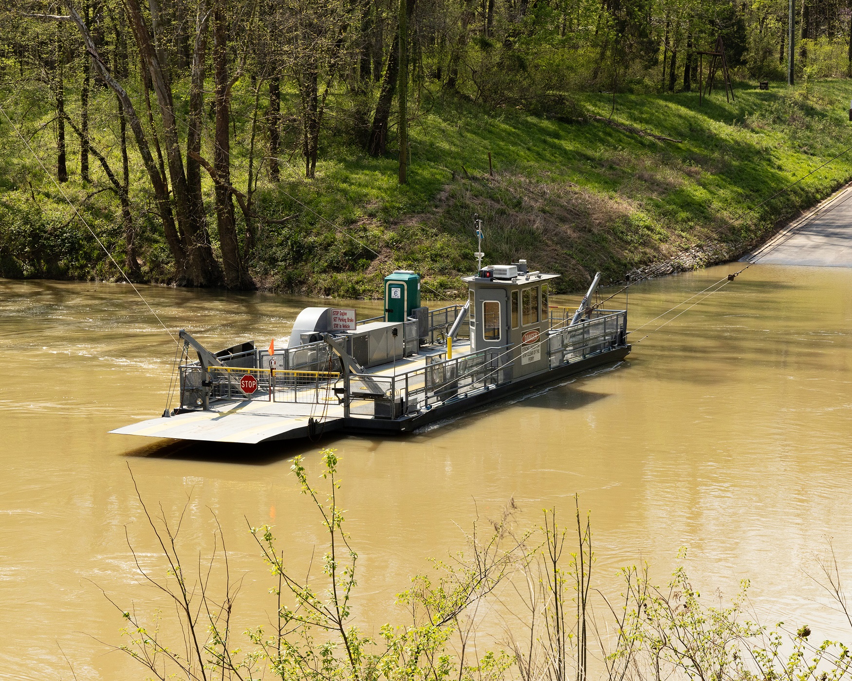
Green River Ferry
Optional ferry crossing · Ferry crossing
Van ConditionalTruck Camper ConditionalClass C ProhibitedOverland ProhibitedClass A ProhibitedTravel Trailer Prohibited
Optional route only. Large rigs should route around via public highways rather than planning around the ferry.
Vehicle size and clearance: Vehicles/trailers must be no more than 16 ft long and 12 tons to board under current NPS guidance.
Current-condition note: Ferry status changes with Green River levels and operational conditions.
✓ Access checked Sep 23, 2026
▤
Nearby Resources
Quick planning essentials
Fuel: Gasoline + Diesel · Dump Station · Repair/Parts
Love's Travel Stop #360 RV dump
10 mi · E/SE via I-65 corridor
Love's official listing confirms unleaded, auto diesel, truck diesel, 161 truck spaces, RV parking and 24-hour operation. Exact visitor-center driving mileage requires route verification before travel. Love's official listing confirms auto diesel, truck diesel and DEF plus heavy-vehicle forecourt infrastructure. Love's official listing confirms truck care, tire services, light mechanical work, RV tires/batteries, RV oil change and RV motorhome mechanical service. This is a stronger named service resource than the former generic corridor row. Exact route mileage remains to be verified. Love's official listing confirms RV dump service. Exact visitor-center mileage and current fee/status remain live.
NPS identifies Caver's Camp Store on Mammoth Cave Parkway as carrying general supplies, snacks and groceries. Use as the immediate park-core grocery/supply option; fuller resupply remains available in Cave City/Horse Cave.
A restored theater gives Ace Coffee Co. its character: coffee and café food share space with curated goods and community events. Stop in downtown Cave City for a creative local counterpoint to Mammoth Cave.
Accuracy note: This guide combines dated source records with planning notes. Missing information is not confirmation that a facility or route is available. Conditions, access and services can change; confirm current details with the responsible agency or operator before travel.
✎
Share Field Info
Help keep the guide current
Recent firsthand information enters a moderation queue and never overwrites verified publication data automatically.