U.S. Fish & Wildlife Service

Okefenokee National Wildlife Refuge

Suwannee Canal Recreation Area / Richard S. Bolt Visitor Center

The main Folkston entrance combines a developed vehicle gateway, Swamp Island Drive, boardwalks and historic sites with permit-controlled paddle routes whose availability can change quickly with water levels.

⌖

GPS30.739° N
82.140° W

▣

Best SeasonWinter · Spring · Fall

$

Estimated 2-Night Spend$175–$600

✓ Source verified · Sep 25, 2026
Image: U.S. Fish & Wildlife Service
MAJOR RESTRICTION

Low water is restricting water trails and wilderness campsites

Historically low water continues to limit paddle access while refuge staff inspect and reopen trails and campsites.

Trip impact: Only selected overnight platforms and trail segments are currently open. Routes may be modified or canceled based on water and trail conditions; all other listed campsites remain temporarily closed until the refuge reopens them.
Live official-source check: activeOfficial status ↗Official U.S. Fish & Wildlife Service source currently confirms the non-routine closure or major travel restriction.
⌖

Overview

Folkston · GA

Use the Suwannee Canal Recreation Area as the drive-in gateway to one of the Southeast’s most distinctive wetland landscapes, then shift modes: wildlife watching and the Swamp Island Drive by road, Chesser Island history and boardwalks on foot, and the refuge’s defining experience by canoe, kayak, or guided boat. The Folkston gateway keeps fuel and resupply within reach while the water-trail system quickly becomes true wilderness travel.

AgencyU.S. Fish & Wildlife Service
Access modelFull-Spectrum Core
Remote campingStrong Remote Option
Checking destination weather…
⌂

Camping Snapshot

Permit-controlled wilderness canoe/kayak camping; developed vehicle camping is outside the main SCRA gateway

Paddle-in wilderness camping only inside the refuge | permit required | canoe/kayak only, no motors | bring all drinking/cooking water | current platforms and water-trail access change with water levels | check current route and water conditions before committing to a route.

Reservation
Wilderness camping requires a refuge permit and Recreation.gov profile. Current FWS pages conflict on the advance-reservation window; use the current conditions notice and permit line rather than relying on a printed window.
Water
Water-bottle refill at Richard S. Bolt Visitor Center. No fresh water is available on wilderness water trails; bring all drinking and cooking water.
Dump
No public vehicle dump station verified at the Suwannee Canal main entrance.
Restrooms
Restrooms outside the visitor center; pit toilets at Chesser Island Homestead and Boardwalk parking; wilderness facilities vary by platform.
$

Trip Cost

2 nights / 3 days
Solo$175–$350
Couple$250–$450
Family of 4$350–$600
Planning band, not a quote. Live fees and availability can change.
▣

Vehicle Access

Core gateway passes the vehicle inclusion gate. Recreation.gov directs visitors to a large parking area, and FWS commercial vehicle fee categories plus public boat-ramp use support highway-vehicle access. Vans and Truck Campers are Suitable; Class C, Overland, Class A, and travel trailer remain Conditional because exact parking-space dimensions are unpublished. Swamp Island Drive is a separate optional zone with unverified large-rig dimensions.
Suwannee Canal Recreation Area main entrance / visitor center

Refuge entrance road · Developed road access

Van SuitableTruck Camper SuitableClass C ConditionalOverland ConditionalClass A ConditionalTravel Trailer Conditional

Core gateway passes the guide inclusion gate. Recreation.gov directs visitors to a large parking area. FWS commercial-vehicle categories include vans, buses, and trucks; the recreation area also has a public boat ramp used by trailered watercraft. Larger/towed rigs remain Conditional because exact parking and turning dimensions are not published.

Swamp Island Drive auto tour

Self-guided auto tour · Designated refuge auto-tour road; exact surface classification not stated on current FWS page

Van SuitableTruck Camper SuitableClass C UnverifiedOverland UnverifiedClass A UnverifiedTravel Trailer Unverified

FWS describes Swamp Island Drive as about seven miles with a lollipop-route turnaround and pull-offs. No published width/height/large-rig limits were found, so larger classes remain Unverified rather than assumed suitable.

Current-condition note: Current refuge operations and temporary restrictions should be checked before entering optional interior routes.

▤

Nearby Resources

Quick planning essentials
Potable Water

Richard S. Bolt Visitor Center

0 mi · At anchor

Water-bottle refill is available at the visitor center. No fresh water is available on wilderness water trails; bring all drinking and cooking water.

Driving Directions ↗
Fuel: Gasoline + Diesel · Propane

Jack rabbit

8 mi · NE / Folkston

Diesel is listed at the same Folkston gateway fuel stop; verify current pump status and price live. Current local-business data lists propane exchange at the same station. Treat as cylinder exchange and verify stock live. Closest verified Folkston gateway fuel stop ; gasoline and convenience supplies. Verify pump pricing/status live.

Driving Directions ↗
Groceries

Winn-Dixie

8 mi · NE / Folkston

Full-service grocery resupply in Folkston before entering the remote refuge gateway.

Driving Directions ↗
Repair/Parts

O'Reilly Auto Parts #5334

8 mi · NE / Folkston

Auto parts, batteries, fluids, testing, and trip-saving maintenance supplies in Folkston.

Driving Directions ↗
EV Charging

Georgia Power Folkston DC / ChargePoint

8 mi · NE / Folkston

Public DC fast-charging location in Folkston. Charger status, connector availability and pricing can change; confirm current status before arrival.

Driving Directions ↗
Laundromat

Folkston Laundromat

8.5 mi · NE / Folkston

Verified self-service laundromat in Folkston; current hours should be confirmed before relying on it.

Driving Directions ↗
Hospital

Southeast Georgia Health System – Camden Campus

39 mi · E / off 20-mile map

Nearest verified hospital-level emergency care in this resource pass is well outside the 20-mile planning ring; call 911 for emergencies.

Driving Directions ↗
⌖

See Nearby

Local culture & context
Guided boat tour / paddling outfitter

Okefenokee Adventures

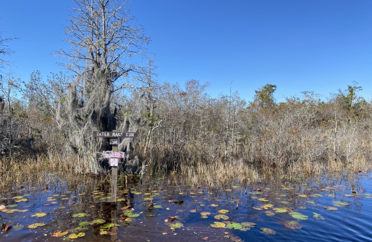
A marked canoe trail through Okefenokee National Wildlife Refuge.
Image: Dan Chapman/USFWS · Public domain

0.1 mi · At anchor · 2+ hr depending on tour · Paid tour/rental

Official on-site concessionaire for guided boat tours, canoe/kayak rentals and other ways to get onto the water from the Folkston entrance.

Historic homestead / cultural history

Chesser Island Homestead

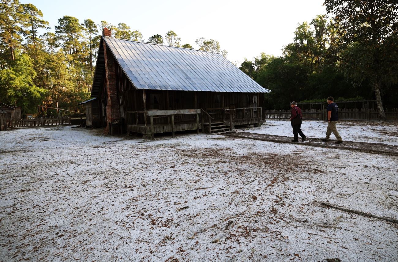
Joe Chesser and his grandson Andrew at the historic Chesser Island Homestead in Okefenokee National Wildlife Refuge.
Image: Renee Bodine/USFWS · Public domain

4.5 mi · W / Swamp Island Drive · 45–75 min · Included with refuge entry

Preserved swamp homestead reached from Swamp Island Drive, adding human history to a destination dominated by wildlife and wetland scenery.

Boardwalk / wildlife / viewpoint

Chesser Island Boardwalk & Owl’s Roost Tower

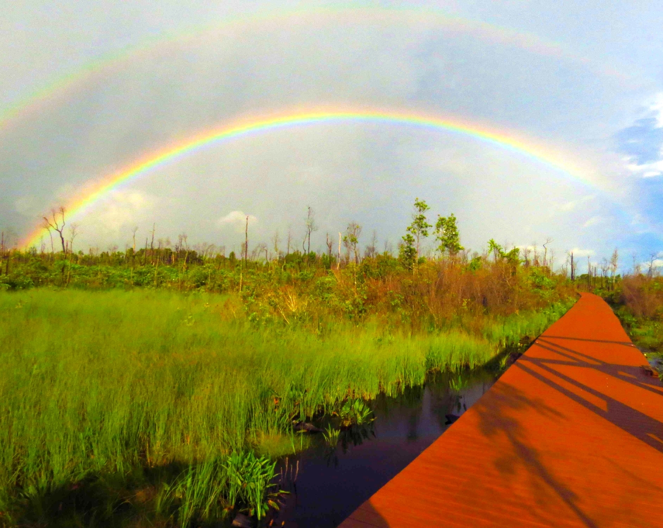
Chesser Island Boardwalk crossing Okefenokee wet prairie beneath a rainbow.
Image: Cindy McIntyre/USFWS · Public domain

5 mi · W / Swamp Island Drive · 1–2 hr · Included with refuge entry

Popular boardwalk through cypress, scrub-shrub and prairie habitat to a 40-foot observation tower with broad swamp views and frequent wildlife opportunities.

Wildlife / self-guided auto tour

Swamp Island Drive

Okefenokee National Wildlife Refuge landscape
Image: George Gentry / U.S. Fish & Wildlife Service / Public Domain

From main entrance · 1–2 hr · Included with refuge entry

A 7.4-mile self-guided auto tour with marked stops for wildlife viewing, trails and historic features inside the Suwannee Canal Recreation Area.

WORTH THE DETOUR

Okefenokee State Park – West Entrance

Remote western gateway to the Okefenokee with camping, water access and exceptionally dark skies; formerly named Stephen C. Foster State Park.

W / Fargo entrance · Half day to overnight · State park fees; current reservations/operations vary

Driving Directions ↗

if time allows, the west entrance provides a quieter, water-focused second perspective on the refuge. Current construction and availability belong in live planning. · 17515 GA Highway 177, Fargo, GA 31631 · 912-637-5274 · gastateparks.org · Current details checked 2026-09-25.

Accuracy note: This digital guide shows the best verified information currently available. Categories without reliable source data may be omitted. Conditions, access, services, and supporting details are continuously reviewed and updated as better information becomes available.

✎

Share Field Info

Help keep the guide current

Recent firsthand information enters a moderation queue and never overwrites verified publication data automatically.